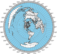
The azimuthal map form can now add labels for US cities. The database of latitude/longitude pairs for cities seems imprecise because some California cities are in the Pacific ocean. It might also mean that the coastal outlines are not precise enough.
If you notice a city out of place, please let me know. There are some errors in the database. For example, San Francisco was a few miles out to sea.
Update: I updated the list of cities to include ones from Alaska and Hawaii.

